


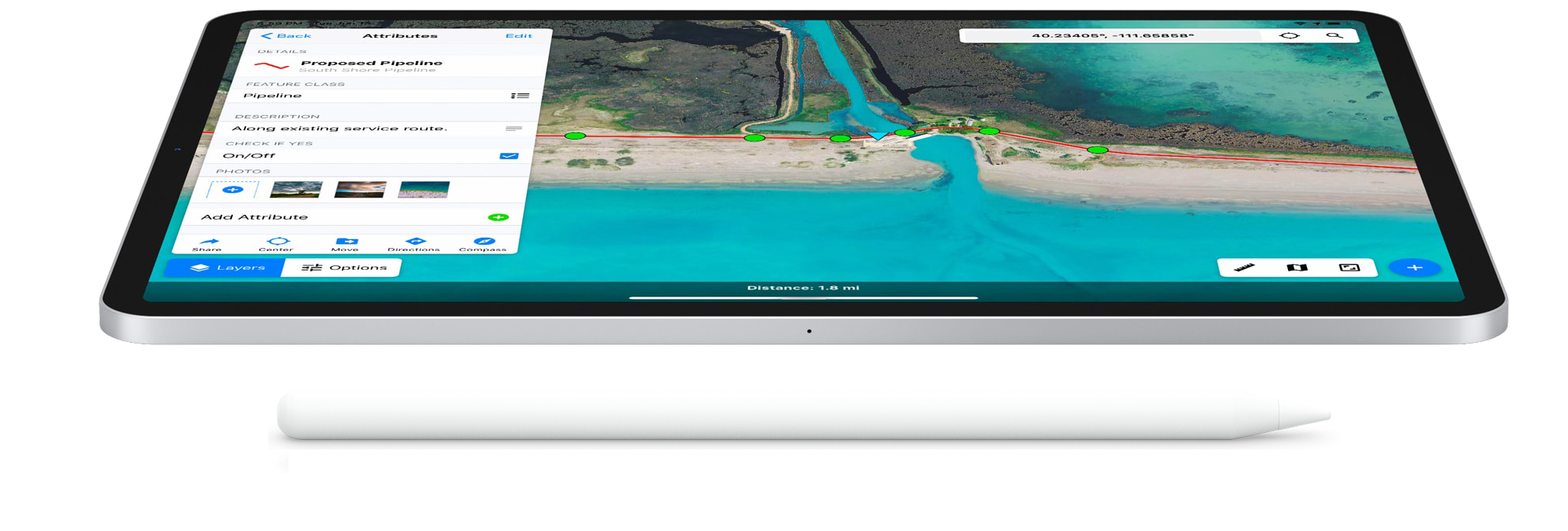
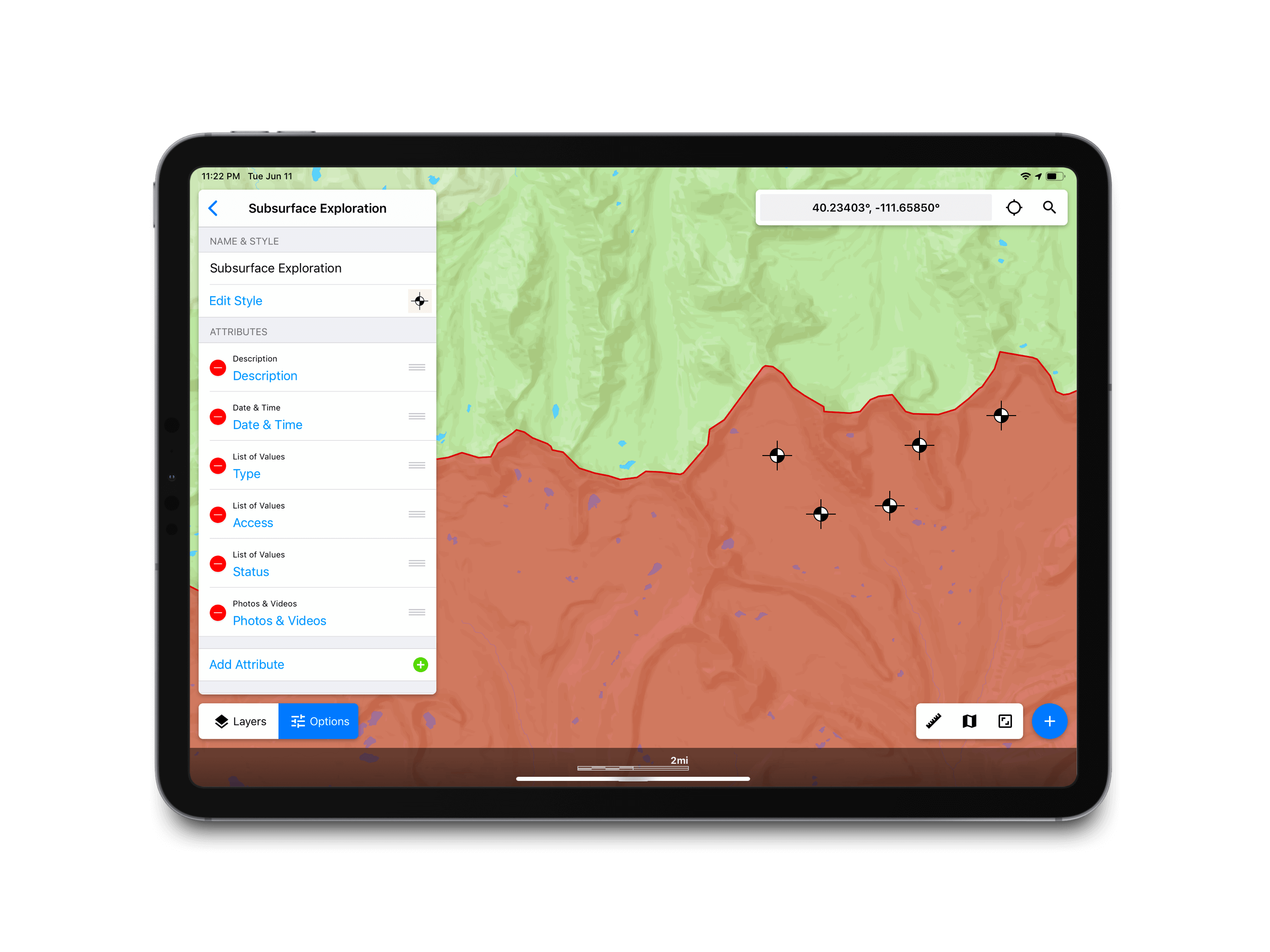
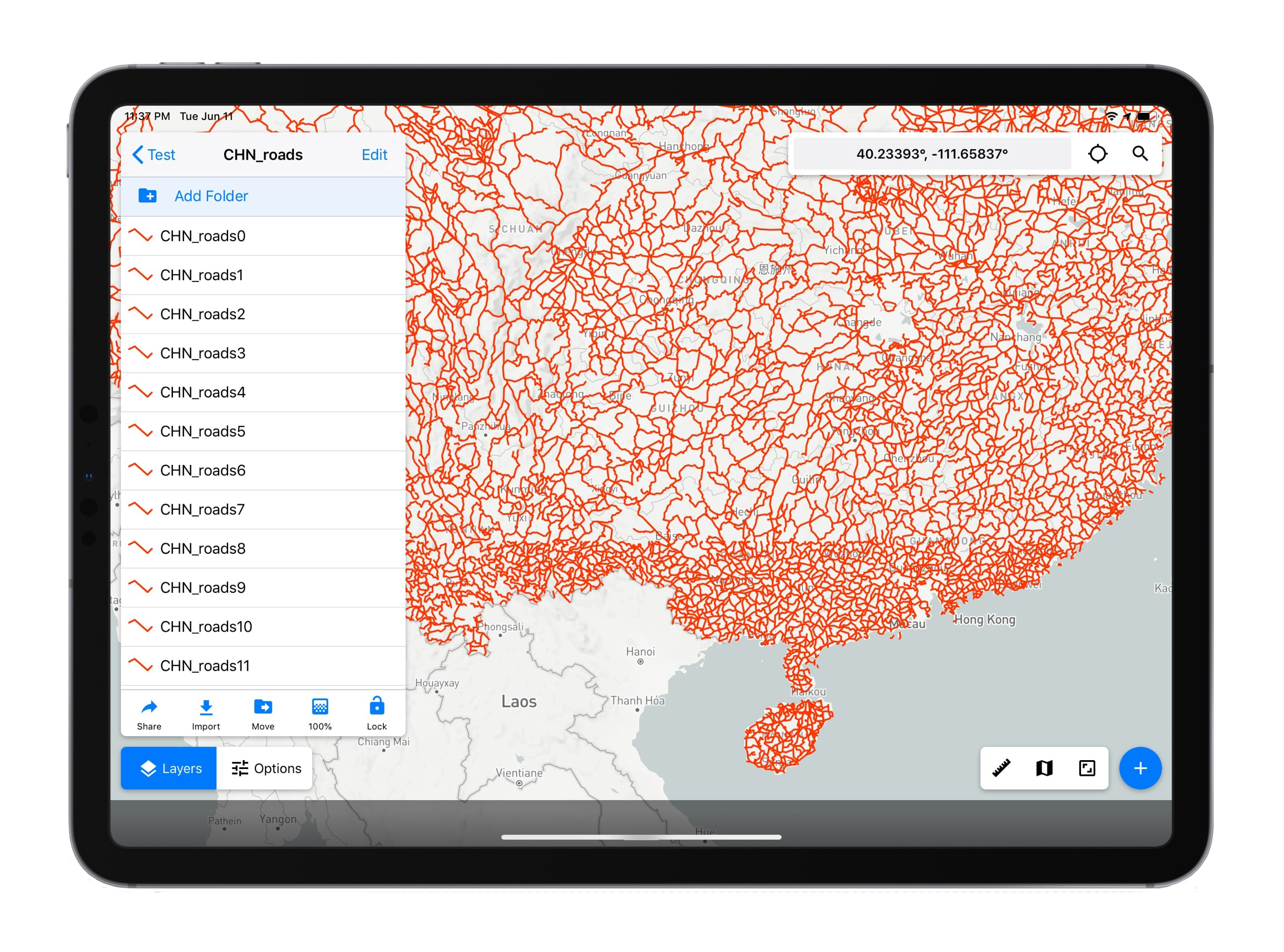
No need to rely on a GIS technician for your feature classes. Create, and edit feature classes in the field or the office. Make adjustments whenever field conditions warrant, or that brilliant new idea strikes.
Learn MoreWorking in a remote area without WIFI or cellular data? No problem. Touch GIS allows you to download map tiles before you leave and use them anywhere.
Learn More
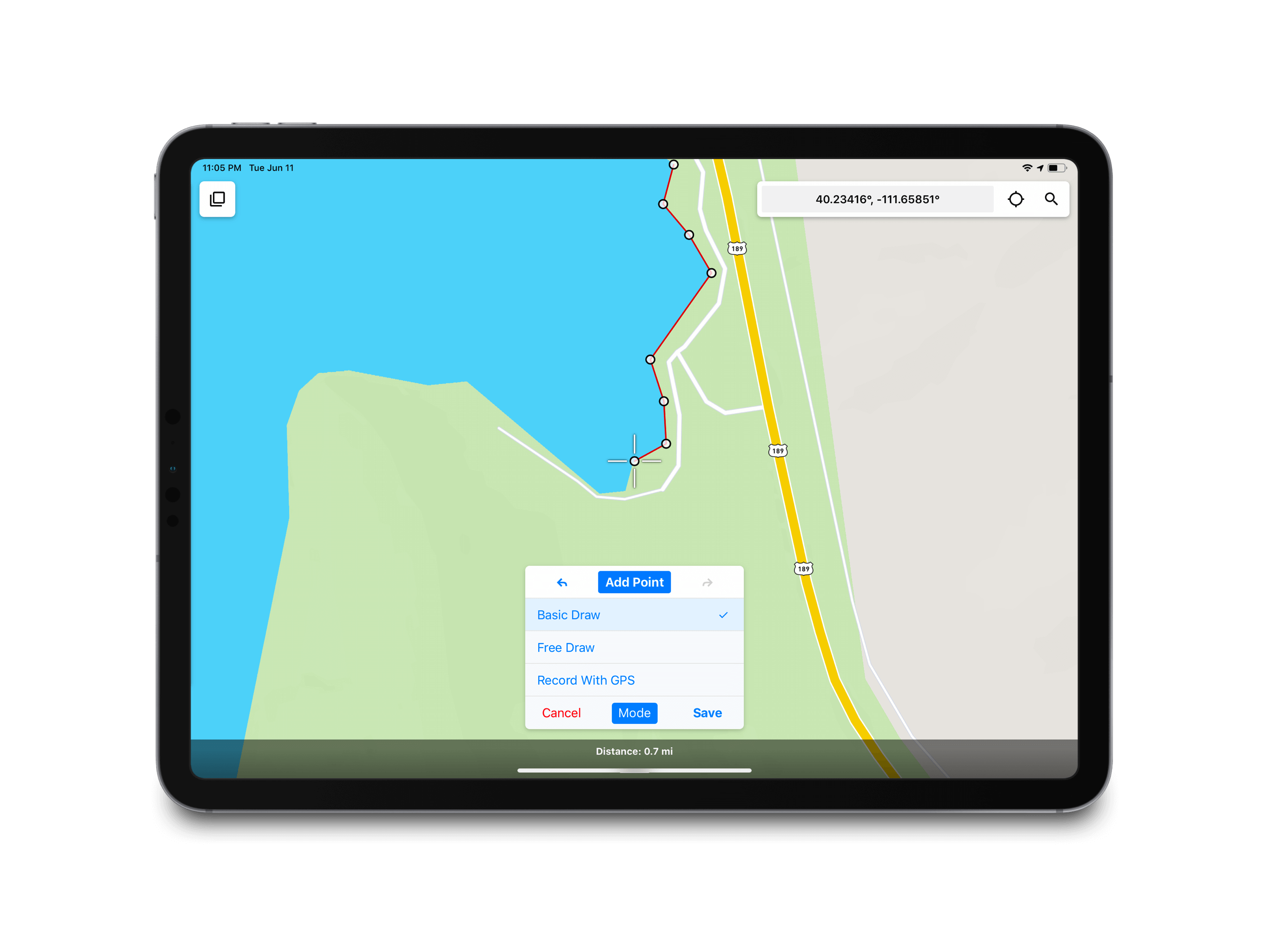
Draw points, lines, and polygons accurately with a variety of drawing methods. Use GPS, draw features manually, or use a stylus. You can even edit the geometry of imported features.
Learn MoreTouch GIS supports a variety of import and export formats for easy sharing and integration with desktop software. No need to change your other workflows. Collect your data in Touch GIS, export to your desktop, and resume your usual process.
Learn More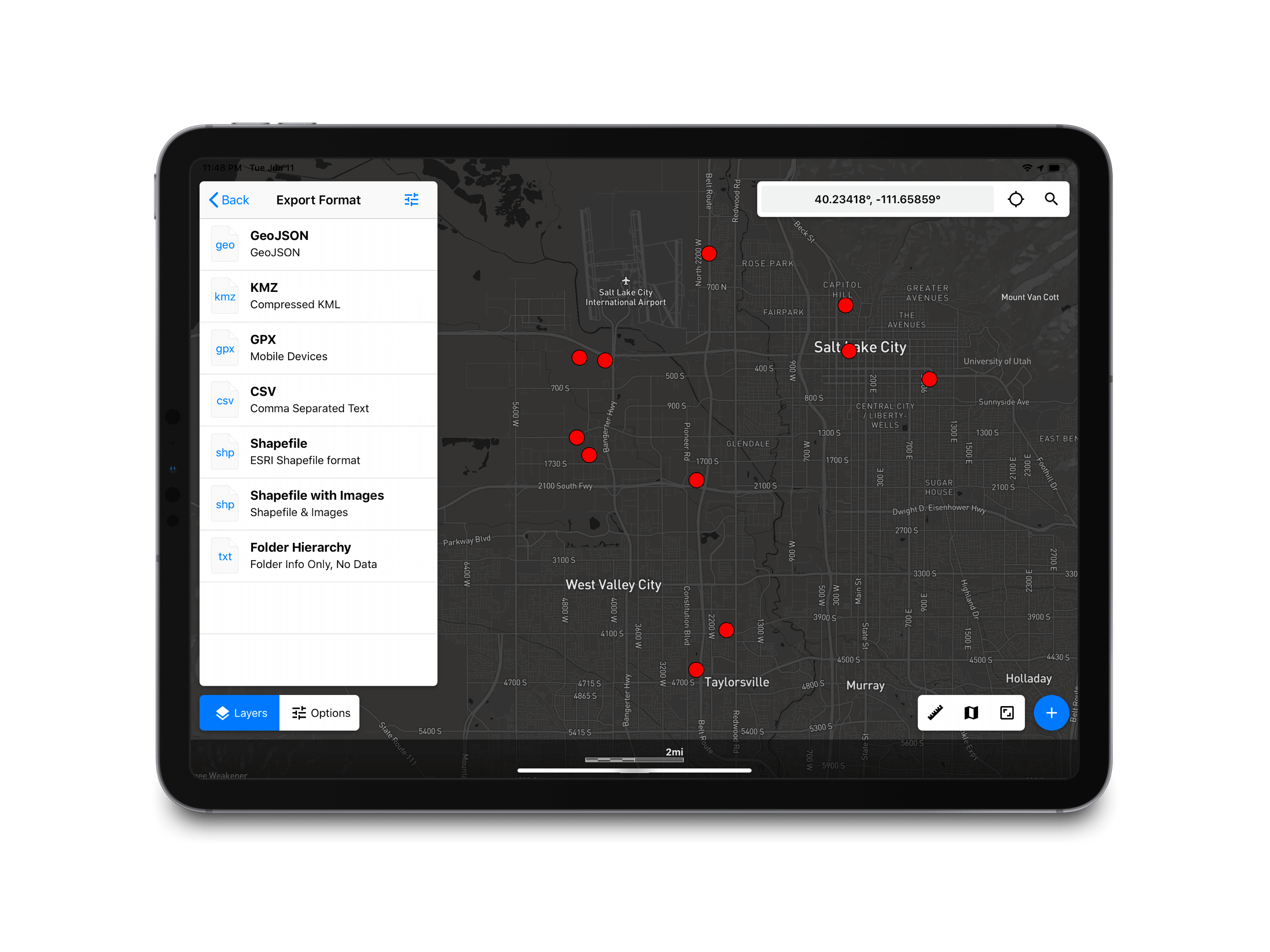
Experience unbeatable map performance. Collect thousands of features per project without sacrificing performance or stability. Choose from a varitey of base maps to help visualize your data.
Learn MoreManage multiple projects in Touch GIS simply and eliminate hours of pre-GIS processing time. Flexible, on-device project management puts you in control of your workflow.
Learn More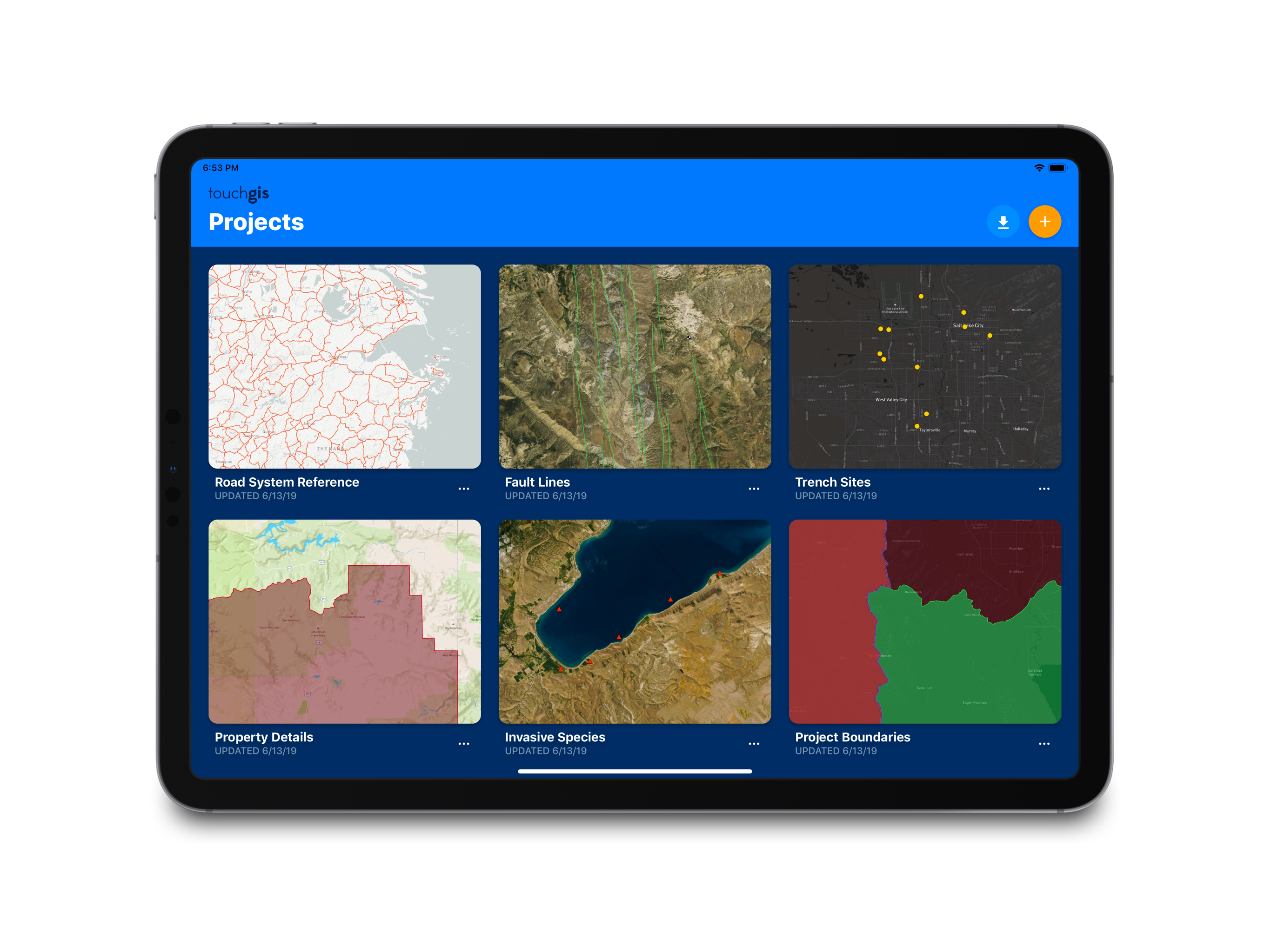


• Points
• Lines
• Polygons
• Create On The Fly
• Customize
• Manage Attributes
• Share Datasets
• Description
• List of Values
• Date & Time
• Checkbox
• Address
• Number
• Website
• Phone Number
• Manual Placement
• GPS Tracking
• Free Draw
• Edit Position
• Add Attributes
• Street
• Outdoor
• Satellite
• Hybrid
• WMS
• Custom URLs
• Offline Support
• Distance Filter
• Time Filter
• Accuracy Filter
• Ultra Accuracy
• Compass
• LAT/LONG
• MGRS
• USNG
• UTM
• Meters
• Yards
• Feet
• Acres
• Hectares
• Nautical Miles
• Shapefile
• KML
• KMZ
• GeoJSON
• GPX
• CSV (export)
From the Project Manager you can create a new project from scratch or import existing data to begin.
This will ensure that you have the map tiles you need. This ensures you have a base map in data dead zones.
Choose an existing Feature Class Dataset or create custom point, line, and polygon classes.
Use Touch GIS’s simple drawing methods to add points, line, and polygons to your project and input attributes.
Export data in a variety formats. Share with colleagues, clients, or export for desktop processing if necessary.
Have questions about how Touch GIS fits into your organization's workflow? Get in touch!

Install Touch GIS on your iPhone or iPad. There is no cost to install the app.
Create your account and start collecting field data - no subscription required to start!
Purchase a subscription to unlock the ability to export data and cache map offline tiles.

